At least 24 species of cetaceans (whales and dolphins) spend all or part of their lives in the U.S. Exclusive Economic Zone around the Hawaiian Islands. Almost 40 separate populations of cetaceans are currently recognized within this area. Some species have populations that live close to shore, like the main Hawaiian Islands insular false killer whale population, but each species has a population that spends all or part of its time in pelagic waters that are far from shore.
While we have a lot to learn about all cetacean populations in Hawaiian waters, we generally know much more about the populations that are close to shore and easily accessible and less about pelagic populations that are far from shore and harder to reach. If you live in or have visited Hawaiʻi, chances are you have heard of or seen spinner dolphins that spend their days resting near the coast or humpback whales that visit the Islands in winter months. However, it is less likely that you have caught a glimpse of a Fraser’s dolphin or a Longman’s beaked whale, as they spend their time in deeper waters far from land.

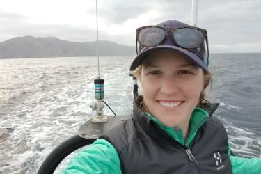
We use estimates of population size, commonly referred to as abundance estimates, to evaluate the impacts of human activities on cetacean populations. These evaluations are an important part of stock assessment reports and conservation and management plans. The Hawaiian Islands Cetacean and Ecosystem Assessment Survey, or HICEAS pronounced "high-seas," is a ship-based, line-transect survey designed to estimate the abundance of cetaceans in the exclusive economic zone around Hawai‘i. Spanning approximately 1.8 million square nautical miles, the HICEAS study area is so large that we need two ships operating for about 180 days during the summer and fall to complete the survey. So far, we have carried out a HICEAS in 2002, 2010, and 2017.
How Do We “Count” Whales and Dolphins?
Line-transect surveys are a common way to collect data necessary to estimate the abundance of cetacean populations both in Hawaiian waters and around the world. Researchers analyze the data collected from line-transect surveys in two different ways: design-based and model-based methods. Design-based (or standard) methods use the transect design of the survey (or how the lines are arranged) to estimate abundance of the study populations. This approach is limiting for conservation and management planning because it only gives one estimate for the entire study area.
Model-based methods use a model to connect animal distribution to environmental variables such as water depth, distance from shore, or sea surface temperature. This approach has less restrictive survey design requirements, allowing researchers to estimate abundance at specific locations within the study area, as well as outside of the study area or period. For these reasons, scientists are increasingly using model-based methods to analyze cetacean line-transect data, but this approach requires more data than design-based methods. We use both approaches to estimate the abundance of cetaceans in the exclusive economic zone around Hawai‘i.

What Have We Learned So Far?
Over the last three years, we published five reports that highlight what we learned about cetacean abundance in Hawaiian waters by analyzing HICEAS and other survey data. The findings in each report, summarized below, have helped us assess and manage cetaceans around the Hawaiian Islands.
Our first featured report provides line-transect abundance estimates of false killer whales in the exclusive economic zone around the Hawaiian Islands and in the central Pacific. There are three populations of false killer whales in Hawaiian waters. They are a high priority species because of the endangered status of the main Hawaiian Islands insular population and the high bycatch rates of the pelagic population in Hawai‘i-based longline fisheries. False killer whales are challenging to study because they are rarely seen and travel in subgroups that are sometimes spread out over tens of miles! We have to use a specially designed data collection protocol on our line-transect surveys to ensure we are counting them correctly.
We used both design- and model-based methods to estimate pelagic false killer whale abundance. The results were broadly similar averaged across each HICEAS year (2002, 2010, and 2017). However, the design-based estimates are highly variable due to random variation (or chance effects) in sighting rates, which are common when collecting data on a rare species in just one year. The model-based approach smooths over this annual variation, and the resulting estimates are more suitable for management. We estimated around 2,000 pelagic false killer whales were in the exclusive economic zone around Hawai‘i during each HICEAS year. While we do not know how far this population extends outside this area, the model-based approach allowed us to estimate density throughout much of the central North Pacific, which is important for mitigating population-level impacts from longline fisheries.

Our second featured report focuses on design-based estimates for 22 other cetacean species, which share common data collection and analysis methodologies. Similar to the false killer whale analysis, estimating abundance following HICEAS 2017 offered an opportunity to update abundance estimates from HICEAS 2002 and 2010 using new relevant data. We estimated abundance in the exclusive economic zone around the Hawaiian Islands for (including false killer whales) 21 species in 2002, 19 species in 2010, and 18 species in 2017. Across all species and years, the abundance estimates range from less than 200 blue whales in 2010 to over 75,000 rough-toothed dolphins in 2017, although most estimates are imprecise due to the low sighting rates typical of pelagic waters in our region.

Our third featured report provides model-based estimates of abundance in the exclusive economic zone around Hawai‘i for eight species with sufficient data: pantropical spotted, striped, rough-toothed, bottlenose, and Risso’s dolphins; and short-finned pilot, sperm, and Bryde’s whales. The model-based estimates were generally comparable to the design-based estimates and more suitable for assessing those species, except for pantropical spotted, bottlenose, and rough-toothed dolphins. For pantropical spotted and bottlenose dolphins, the models did not separate the pelagic from the island-associated populations due to data limitations. For rough-toothed dolphins, the model was not able to predict changes in abundance based on environmental variability.
Our fourth featured report presents updated model-based estimates following the winter HICEAS (WHICEAS) of 2020. This survey gave us an opportunity to estimate cetacean abundance during winter when the number of seasonally-migrating baleen whales (like humpback whales) is at its highest. WHICEAS 2020 took place over only approximately 50 days and focused just on waters around the main Hawaiian Islands, but it provided more intensive survey coverage within that area.
The model-based estimation found seasonal differences only for humpback whales, allowing us to estimate their abundance in the exclusive economic zone around Hawai‘i at different times throughout each year. We estimated that over 11,000 humpback whales were present in 2020 during mid-February to mid-March, the period of their peak abundance around Hawaiʻi. Although, the total number of individual whales visiting Hawai‘i during “whale season” (November-April) is no doubt higher. We were unable to update the model-based estimates for false killer and sperm whales after WHICEAS 2020. However, we did estimate model-based abundance for the remaining seven species mentioned above–including the pelagic populations of spotted and bottlenose dolphins–and update each of their stock assessment reports.

Our fifth (and final!) featured report provides design-based abundance estimates for 17 cetacean species sighted during WHICEAS 2020. This effort was the first ever multi-species assessment of winter abundance around the main Hawaiian Islands. Across all species, the abundance estimates range from 115 fin whales to over 25,000 melon-headed whales. The low sighting rates led to imprecise estimates for most species and low statistical power to detect seasonal trends in abundance for nine toothed whale species sighted around the main Hawaiian Islands during both HICEAS 2017 and WHICEAS 2020. The sperm whale estimates were an exception, suggesting a significant increase in sperm whale abundance in winter 2020 from summer and fall 2017. Random variation may be a factor, but the changes in abundance could represent seasonal migration patterns.
The Counting Continues
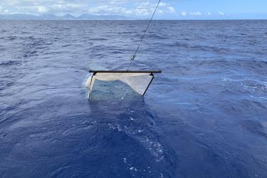
The abundance estimates presented in these five recent reports are based on data from visual observations. Since cetaceans are highly vocal, we simultaneously collect passive acoustic data to improve our abundance estimates. Moving forward, we are working to estimate cetacean abundance directly from passive acoustic platforms. HICEAS 2023 is now underway and will continue the legacy of this important effort: gathering the visual and acoustic data we need to update abundance estimates for the assessment and management of cetaceans in Hawaiian waters. We look forward to continuing our counts!