Refine Results
Region
Topic
Species Category

All Science & Data

11 resources match your filter criteria.

Sailing the High Seas: Two Decades of Counting Whales and Dolphins in Hawaiian Waters

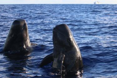
The Hawaiian Islands Cetacean and Ecosystem Assessment Surveys of 2002, 2010, and 2017 provided critical data on the sizes of whale and dolphin populations. With HICEAS 2023 underway, we reflect on what we have learned about cetacean abundance in Hawaiʻi.
August 22, 2023 - Survey ,
Two pilot whales bob their bodies out of the water while looking at researchers. Two short-finned pilot whales spyhop at researchers on a small boat, launched from the NOAA Ship Oscar Elton Sette (in the background) during HICEAS 2017. Credit: NOAA Fisheries/Paula Olson (Permit #20311)

Identifying Social Clusters of Endangered Main Hawaiian Islands False Killer Whales

In this study, we used photo-identification data over a 23 year period to reassess the number and membership of social clusters for false killer whales.
August 05, 2023 - Peer-Reviewed Research ,

Tracking Time Differences of Arrivals of Multiple Sound Sources in the Presence of Clutter and Missed Detections

This study proposes a multi-target tracking method to automate TDOA tracking demonstrated on false killer whale recordings from Hawaiian waters.
November 05, 2021 - Peer-Reviewed Research ,

Patterns of Depredation in the Hawai’i Deep-Set Longline Fishery Informed by Fishery and False Killer Whale Behavior

We analyzed behavior data on false killer whales to identify patterns that could help fishermen avoid interactions with whales.
August 04, 2021 - Peer-Reviewed Research ,

Surveying Whales and Dolphins During a Pandemic

Researchers “quaran-teamed” for the Marianas research expedition in the name of science.
July 09, 2021 - Survey ,
A screenshot of a MACS daily virtual meeting. A serenade for a team member’s birthday during a daily virtual meeting. Photo: NOAA Fisheries.

False Killer Whale Stock Boundary Maps

Range maps for populations (stocks) of false killer whales in Hawaiian waters.
February 10, 2021 - Map ,

Whistle Classification of Sympatric False Killer Whale Populations in Hawaiian Waters Yields Low Accuracy Rates

In the Hawaiian Archipelago, three genetically distinct false killer whale populations coexist. Researchers investigated whether their whistles could be used to identify populations in acoustic recordings when genetic or photographic-identification data are unavailable.
October 18, 2019 - Peer-Reviewed Research ,

Abundance Estimates for Management of Endangered False Killer Whales in the Main Hawaiian Islands

This collaboration between NOAA, non-profit, and citizen scientists, provides the first reliable abundance estimates of endangered main Hawaiian Islands false killer whales for management.
September 10, 2018 - Peer-Reviewed Research ,

Main Hawaiian Islands Insular False Killer Whale Critical Habitat Map and GIS Data

Map and GIS data representing critical habitat for the main Hawaiian Islands insular false killer whales in waters from 45 meters to 3,200 meters (49 to 3,500 yards) in depth surrounding the main Hawaiian Islands (from Ni‘ihau to Hawai‘i Island).
July 24, 2018 - Map ,
Map showing critical habitat areas for main Hawaiian Islands insular false killer whales

That's a Wrap: HICEAS 2017 is Complete!

HICEAS: Hawaiian Islands Cetacean and Ecosystem Assessment Survey

Highlights from the seventh and final leg of a 6-month project.
December 29, 2017 - Research ,
3788x2841-01_LaskerLeg4-NOAA-PIFSC.jpg Lasker Leg 4 science team adorned with Hawaiian leis just before departing Honolulu on November 15, 2017. Credit: NOAA Fisheries/Amanda Bradford