While the weather outside may be frightful this time of year, Northeast Fisheries Science Center researchers continue collecting data from planes, ships, and underwater.
Many of the studies are part of the Atlantic Marine Assessment Program for Protected Species, or AMAPPS. This multi-year program is funded by NOAA, the Bureau of Ocean Energy Management, the U.S. Fish and Wildlife Service, and the U.S. Navy. Researchers put information about abundance, distribution, ecology, and behavior of protected species—from whales, dolphins, and seals to marine turtles and seabirds—into an ecosystem context. This helps resource managers with conservation measures and decision-making.
Aerial Surveys

NOAA Fisheries scientists and colleagues from state and non-profit organizations conducted aerial surveys in the Northeast region through December 2019. Flights will resume on February 1. The focus is on right whale sightings in and near Nantucket Shoals, where many whales have been aggregating recently. We will also survey other areas where right whales were seen in the past.
Two recent aerial surveys used NOAA Twin Otter aircraft. The Northeast center’s aerial whale survey team conducts one based at Air Station Cape Cod. Center staff and colleagues from other marine research organizations conducted a survey specifically for AMAPPS last fall, based at Barnstable Municipal Airport in Hyannis, Massachusetts.
AMAPPS surveys moved to southeast U.S. waters off Florida and Georgia in early December and will continue there through the end of January 2020.
Shipboard Activities

The Northeast center collects oceanographic and environmental data on its own shipboard survey cruises throughout the year. The seasonal ecosystems monitoring survey has AMAPPS marine mammal and seabird observers aboard.
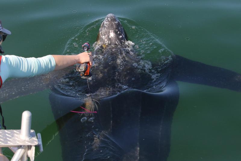
Using small research vessels, scientists conduct seal research from December through early February—gray seal pupping season—and other times of the year. Their research area covers Cape Cod and nearby islands including Nantucket, and Seal Island in Maine.
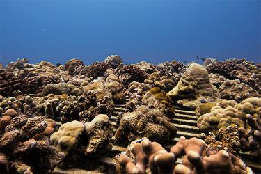
Ecosystem monitoring surveys south of Nantucket also collect plankton samples and other data that could shed light on why and when right whales aggregate in that area. The Center schedules short-duration zooplankton sampling trips from January through April, when whales are in the area. Researchers use a variety of sampling gear—nets, acoustics, a video plankton recorder. They match sampling Canada’s Department of Fisheries and Oceans does during the summer near foraging whales in the Gulf of St. Lawrence.
“The goal is to align our data collections and analyses with theirs, allowing for collaborations on data processing and analysis techniques to understand what attracts Calanus copepods, small crustaceans favored by right whales,” said Harvey Walsh, who leads the ecosystem monitoring program at the Northeast Fisheries Science Center.
“Understanding the physical and biological features that aggregate right whale prey in different regions should improve tools for forecasting right whale foraging areas,” Walsh said. “Improved knowledge of right whale distribution is key to developing effective management measures that won’t have a negative impact on fishermen and other users of transboundary ocean resources.”
Upcoming Cruises to Focus on Offshore Waters

The NOAA Ship Gordon Gunter will conduct a 67-day AMAPPS abundance survey between February and May 2020. The survey will start in the Gulf of Mexico and follow a track up the East Coast to Rhode Island. Staff from both the northeast and southeast fisheries science centers will focus on offshore waters south of Virginia to estimate the abundance of marine mammals and seabirds, using high-powered binoculars and underwater passive acoustics. We will also conduct oceanographic and planktonic sampling along the way.
We plan North Atlantic right whale and turtle biology research cruises in late spring. In July 2020, center researchers and colleagues will collect data on little-known, deep-diving cetacean species like beaked whales and sperm whales. Other protected species research projects will take advantage of surveys aboard vessels from other marine research organizations.
Leatherback Turtle Tagging in Cape Cod Bay Ramps Up
After two years of pilot studies, 2019 marked the first year of full sampling with the new AMAPPS emphasis on leatherback turtle tagging.
Leatherbacks were plentiful in Cape Cod Bay and Vineyard and Nantucket Sounds into the fall of 2019, enabling turtle researchers to tag 24 leatherbacks using the center’s small research vessel Selkie with a new suction cup tag.
Stay tuned, as 2020 promises to be another busy year!