Atlantic Sea Scallop
Atlantic Sea Scallop
Placopecten magellanicus

Quick Facts
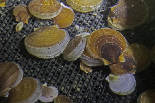
 Dense beds of small scallops photographed on the ocean floor in the Mid-Atlantic in 2015. Credit: NOAA Fisheries
Dense beds of small scallops photographed on the ocean floor in the Mid-Atlantic in 2015. Credit: NOAA Fisheries
About the Species
The primary Atlantic sea scallop fishery operates along the Atlantic coast from the Mid-Atlantic to the US/Canada border. The scallop fishery uses predominantly paired or single scallop dredges throughout the entire range of the fishery. To a lesser extent, and mainly in the Mid-Atlantic region, the scallop fishery uses trawl gear. Most vessels land scallops as shucked meats (the adductor muscle) but some vessels also land whole (in-shell) scallops. U.S. wild-caught Atlantic sea scallop is a smart seafood choice because it is sustainably managed and responsibly harvested under U.S. regulations. Implementing regulations are found at 50 CFR part 648 subpart D.

Population
The stock is not overfished.

Fishing Rate
Not subject to overfishing.

Habitat Impact
Area closures and gear restrictions protect habitat that are affected by some kinds of trawl and dredge gear.

Bycatch
Regulations are in place to minimize bycatch.
Population Status
- According to the 2020 stock assessment, Atlantic sea scallop is not overfished and not subject to overfishing. Summary stock assessment information can be found on Stock SMART.
Appearance
- Scallops are bivalves (having two shells), like clams and oysters.
- The shells are held together by the adductor muscle (the part of the scallop Americans typically eat).
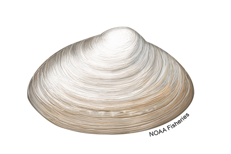
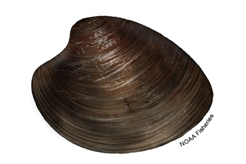
- Sea scallops have a saucer-shaped shell with scalloped or fluted edges.
- The upper shell is usually reddish-pink or brown in color. The lower shell is white or cream.
- A small percentage (5–10 percent) of sea scallops are albinos, with white upper and lower shells.
- Sea scallop shells are smooth and lack the prominent ribbing that is characteristic of most other scallop shells. It is thought that the sea scallop’s smooth shell is an adaptation to allow it to propel itself faster and farther.
Biology
- Sea scallops can live up to 20 years. They grow quickly for the first few years of their life.
- The largest scallop ever reported was about 9 inches in shell height, but they typically don’t grow larger than 6 inches.
- Sea scallops can reproduce by age 2, but don’t produce many eggs or sperm until they are about 4 years old.
- They are very fertile—a female sea scallop can produce hundreds of millions of eggs per year. For this reason, scallops may respond more rapidly to management actions than species that reproduce slowly and in small numbers.
- Sea scallops usually spawn in late summer or early fall. They also may spawn in the spring, especially in the Mid-Atlantic Bight.
- After hatching, scallop larvae remain in the water column for 4 to 6 weeks before settling on the ocean floor.
- Sea scallops feed by filtering phytoplankton or other small organisms out of the water column, which can actually help to improve water quality by removing suspended materials.
- Many kinds of pelagic fish and invertebrates eat scallop larvae.
- Cod, wolffish, eel pout, flounder, crabs, lobster, sea turtles, and sea stars feed on juvenile and adult scallops.
- Using its adductor muscle to snap its top and bottom shells open and shut, a sea scallop can propel itself through the water. This helps them escape predators, such as sea stars, that other bivalves like mussels, clams, and oysters can’t avoid.
Where They Live
Range
- Atlantic sea scallops are found in the Northwest Atlantic Ocean, from Newfoundland to Cape Hatteras, North Carolina.
Habitat
- Adult scallops live close together in groups called “beds,” on sandy or gravelly parts of the ocean floor.
- They are generally found at depths of about 100 to 300 feet on Georges Bank and in the Mid-Atlantic.
- Sea scallops can be found in shallower waters in Maine and Canada.
Fishery Management
- NOAA Fisheries and the New England Fishery Management Council manage the Atlantic sea scallop fishery.
- Managed under the Atlantic Sea Scallop Fishery Management Plan:
- Managers determine a total allowable catch for the scallop fishery based on estimates of the scallop population. They allocate this catch amount to different groups of the fishery, depending on their permit type and historical catch, through days-at-sea and number of trips to special access areas.
- Other management measures include:
- Limits on crew size.
- Areas closed to scallop dredging to allow young scallops to grow large and reproduce, and to reduce bycatch of non-targeted species.
- Vessels harvesting scallops must use vessel monitoring systems (a satellite communications system used to monitor fishing activities).
- Individual Fishing Quotas (IFQs), a type of catch share program, for Limited Access General Category permit holders.
- There is a sea scallop fishery in the Gulf of Maine that operates in both federal and state waters. This fishery primarily occurs in Maine state waters and is managed by the state through gear and seasonal restrictions and rotational closures. The federal component of the fishery is managed through daily catch limits and gear restrictions.
Harvest
- Commercial fishery:
- In 2023, commercial landings of Atlantic sea scallop totaled 27.4 million pounds of sea scallop meats and were valued at $360 million, according to the NOAA Fisheries commercial fishing landings database.
- Scallop vessels from Massachusetts, Virginia, and New Jersey are responsible for the majority of the U.S. harvest.
- The principal U.S. commercial fisheries for sea scallop are in the Mid-Atlantic (from Virginia to Long Island, New York) and on Georges Bank and neighboring areas, such as the Great South Channel and Nantucket Shoals. There is also a small, primarily inshore fishery for sea scallops in the Gulf of Maine.
- The U.S. sea scallop fishery is extremely important to the U.S. economy and is the largest wild scallop fishery in the world.
- Gear types, habitat impacts, and bycatch:
- U.S. commercial fishermen harvest sea scallops year-round, primarily using turtle deflector–style scallop dredges that catch scallops much like rakes collect leaves.
- A small number of fishermen use otter trawls, mostly in the Mid-Atlantic.
- Divers and Digby dredges are sometimes used in near-shore areas in the Gulf of Maine.
- The bottom fishing gears used to harvest scallops, such as dredges and trawls, can remove some bottom habitat–forming organisms, including tubeworms and sponges.
- Managers have implemented a variety of measures to protect habitat from potential impacts of fishing gear:
- Several areas are closed year-round to harvesting scallops to protect sensitive habitat.
- Managers have implemented a rotational access area program, which restricts where and when scallop vessels can fish, benefitting both habitat and scallop populations.
- Fishermen use 4-inch rings in their scallop dredges that increase the dredges’ efficiency, catching larger scallops and allowing smaller scallops and other small marine life to return to the sea floor by passing through the dredge rings. The 4-inch rings reduce the amount of time dredges contact the bottom.
- Sea turtles, finfish (such as yellowtail flounder, skates, and monkfish), and undersized scallops can be incidentally caught in the scallop fishery.
- Managers seasonally prohibit fishing in areas where finfish species congregate, reducing catch of these untargeted species.
- Scallop fishermen receive annual allocations of windowpane and yellowtail flounder that they can catch. If the catches are exceeded, managers will implement measures to minimize catch of these species in a future fishing year (e.g., gear restrictions and seasonal closures).
- Scallop vessels in the Mid-Atlantic must use a turtle deflector dredge and chain mat when and where sea turtles occur on scallop grounds. The turtle deflector dredge excludes sea turtles from being caught in the dredge and prevents serious injuries to the turtles.
- Scallop dredges using “twine-tops” must adhere to gear modifications designed to allow fish to escape.
- Research and experimentation with different techniques and gears, as well as education efforts, have helped reduce bycatch.
- Managers and the fishing industry continue to collaborate to redesign scallop dredges to reduce flounder bycatch and to minimize injuries to and capture of sea turtles.
Scientific Classification
- Atlantic sea scallops are found in the Northwest Atlantic Ocean, from Newfoundland to Cape Hatteras, North Carolina.
- Adult scallops live close together in groups called “beds,” on sandy or gravelly parts of the ocean floor.
- They are generally found at depths of about 100 to 300 feet on Georges Bank and in the Mid-Atlantic.
- Sea scallops can be found in shallower waters in Maine and Canada.
Fishery Management
- NOAA Fisheries and the New England Fishery Management Council manage the Atlantic sea scallop fishery.
- Managed under the Atlantic Sea Scallop Fishery Management Plan:
- Managers determine a total allowable catch for the scallop fishery based on estimates of the scallop population. They allocate this catch amount to different groups of the fishery, depending on their permit type and historical catch, through days-at-sea and number of trips to special access areas.
- Other management measures include:
- Limits on crew size.
- Areas closed to scallop dredging to allow young scallops to grow large and reproduce, and to reduce bycatch of non-targeted species.
- Vessels harvesting scallops must use vessel monitoring systems (a satellite communications system used to monitor fishing activities).
- Individual Fishing Quotas (IFQs), a type of catch share program, for Limited Access General Category permit holders.
- There is a sea scallop fishery in the Gulf of Maine that operates in both federal and state waters. This fishery primarily occurs in Maine state waters and is managed by the state through gear and seasonal restrictions and rotational closures. The federal component of the fishery is managed through daily catch limits and gear restrictions.
Harvest
- Commercial fishery:
- In 2023, commercial landings of Atlantic sea scallop totaled 27.4 million pounds of sea scallop meats and were valued at $360 million, according to the NOAA Fisheries commercial fishing landings database.
- Scallop vessels from Massachusetts, Virginia, and New Jersey are responsible for the majority of the U.S. harvest.
- The principal U.S. commercial fisheries for sea scallop are in the Mid-Atlantic (from Virginia to Long Island, New York) and on Georges Bank and neighboring areas, such as the Great South Channel and Nantucket Shoals. There is also a small, primarily inshore fishery for sea scallops in the Gulf of Maine.
- The U.S. sea scallop fishery is extremely important to the U.S. economy and is the largest wild scallop fishery in the world.
- Gear types, habitat impacts, and bycatch:
- U.S. commercial fishermen harvest sea scallops year-round, primarily using turtle deflector–style scallop dredges that catch scallops much like rakes collect leaves.
- A small number of fishermen use otter trawls, mostly in the Mid-Atlantic.
- Divers and Digby dredges are sometimes used in near-shore areas in the Gulf of Maine.
- The bottom fishing gears used to harvest scallops, such as dredges and trawls, can remove some bottom habitat–forming organisms, including tubeworms and sponges.
- Managers have implemented a variety of measures to protect habitat from potential impacts of fishing gear:
- Several areas are closed year-round to harvesting scallops to protect sensitive habitat.
- Managers have implemented a rotational access area program, which restricts where and when scallop vessels can fish, benefitting both habitat and scallop populations.
- Fishermen use 4-inch rings in their scallop dredges that increase the dredges’ efficiency, catching larger scallops and allowing smaller scallops and other small marine life to return to the sea floor by passing through the dredge rings. The 4-inch rings reduce the amount of time dredges contact the bottom.
- Sea turtles, finfish (such as yellowtail flounder, skates, and monkfish), and undersized scallops can be incidentally caught in the scallop fishery.
- Managers seasonally prohibit fishing in areas where finfish species congregate, reducing catch of these untargeted species.
- Scallop fishermen receive annual allocations of windowpane and yellowtail flounder that they can catch. If the catches are exceeded, managers will implement measures to minimize catch of these species in a future fishing year (e.g., gear restrictions and seasonal closures).
- Scallop vessels in the Mid-Atlantic must use a turtle deflector dredge and chain mat when and where sea turtles occur on scallop grounds. The turtle deflector dredge excludes sea turtles from being caught in the dredge and prevents serious injuries to the turtles.
- Scallop dredges using “twine-tops” must adhere to gear modifications designed to allow fish to escape.
- Research and experimentation with different techniques and gears, as well as education efforts, have helped reduce bycatch.
- Managers and the fishing industry continue to collaborate to redesign scallop dredges to reduce flounder bycatch and to minimize injuries to and capture of sea turtles.
Scientific Classification
| Kingdom | Animalia | Phylum | Mollusca | Class | Bivalvia | Order | Pectinida | Family | Pectinidae | Genus | Placopecten | Species | magellanicus |
|---|
Featured News
 Deploying HabCam V4 from the NOAA Ship Henry B. Bigelow on the 2024 Integrated Sea Scallop and HabCam Research Survey. Credit: NOAA Fisheries/Dvora Hart
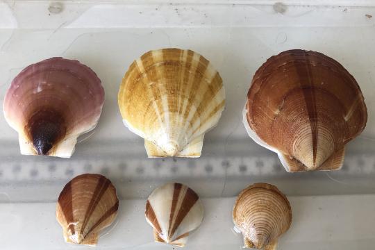 Atlantic sea scallops collected during the 2022 survey show the variety in coloration for this species. Credit: NOAA Fisheries/Christine Kircun
 Juvenile sea scallops obtained from Pine Point Oyster Company in Maine were used in this ocean acidification exposure study.
New Study Finds Ocean Acidification and Warming Hinder Juvenile Atlantic Sea Scallop Growth
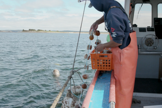 Fishermen lowers sea scallops into the water. Credit: NOAA Fisheries.
Farming Sea Scallops in Maine Offers New Opportunities and Builds Community Resilience
Related Species

Commercial Fishing Regulations
Fishing Year 2025 Scallop Fishery Allocations
Catch Limits | 2025 (mt) |
Overfishing Limit (OFL) | 28,970 |
ABC/ACL (discards removed) | 17,901 |
Incidental Landings | 23 |
RSA | 578 |
Observer Set-Aside | 179 |
ACL for fishery | 16,815 |
Limited Access ACL | 15,890 |
LAGC Total ACL | 925 |
LAGC IFQ ACL (5 percent of ACL) | 841 |
Limited Access with LAGC IFQ ACL (0.5 percent of ACL) | 84 |
Limited Access ACT | 13,771 |
NGOM Set-Aside | 306 |
APL (after set-asides removed) | 8,180 |
Limited Access APL (94.5 percent of APL) | 7,730 |
Total IFQ Annual Allocation (5.5 percent of APL)2 | 450 |
LAGC IFQ Annual Allocation (5 percent of APL)2 | 409 |
Limited Access with LAGC IFQ Annual Allocation (0.5 percent of APL)2 | 41 |
Quotas
Quotas for Atlantic sea scallop fishery change every year or every two years. If specifications are not in place at the start of a fishing year, default specifications will go into place.
Size Requirements
Minimum Shell Height
The minimum shell height for in-shell scallops that may be landed or possessed at or after landing is 3.5 inches (8.9 cm). Shell height is a straight line measurement from the hinge to the part of the shell that is farthest away from the hinge.
Maximum Shell Height
There is no maximum scallop size.
Possession and Trip Limits
Scallop possession limits vary by permit, area, and year.
To see the Limited Access scallop vessel allocations for the 2025 fishing year, read the April 18, 2025 bulletin—2025 Fishing Year Limited Access Allocations for the Atlantic Sea Scallop Fishery
To see the Limited Access General Category scallop vessel allocations for the 2025 fishing year, read the April 18, 2025, bulletin—2025 Fishing Year Individual Fishing Quota Allocations for the Atlantic Sea Scallop Fishery.
One-for-One Access Area Allocation Exchanges
Vessels may exchange unharvested scallop pounds allocated into one access area for another vessel's unharvested scallop pounds allocated into another access area. These exchanges may only be made in 6,000-lb increments between vessels in the same permit category.
In addition, these exchanges may be made only between vessels with the same permit category: A full-time vessel may not exchange allocations with a part-time vessel, and vice versa.
Atlantic Sea Scallop Individual Fishing Quota Cost Recovery Program
2016 Annual Report (June 2017)
- 2021 Annual Report (April 2022)
- 2022 Annual Report (June 2023)
Other Species Regulations
Northeast Multispecies
Possession Limits for LAGC Vessels
LAGC vessels are prohibited from landing Northeast multispecies, unless they are on a declared Northeast multispecies trip (i.e., they cannot be on a declared IFQ trip and retain Northeast multispecies).
Possession Limits for LA Vessels
Unless otherwise prohibited, limited access scallop vessels also issued a valid Northeast multispecies permit, that have declared into a trip and fishing within the Sea Scallop Access Areas may possess and land, per trip, up to a maximum of 1,000 lb of all New England multispecies combined.
Additional restrictions for Atlantic cod, haddock, and yellowtail flounder are listed below:
Atlantic cod: Vessels may possess up to 100 lb (45.4 kg) of Atlantic cod per trip, provided such fish is intended for personal use only and cannot be not sold, traded, or bartered
Haddock: Vessels may possess and land haddock up to the overall possession limit of all Northeast multispecies combined, except that vessels are prohibited from possessing or landing haddock from January 1 through June 30
Yellowtail Flounder: Vessels are prohibited from possessing yellowtail flounder
Scallop DAS Trips
Unless otherwise prohibited, limited access scallop vessels also issued a valid Northeast multispecies permit, that have declared into the scallop DAS program may possess and land, per trip:
Northeast Multispecies: A maximum of 300 lb of all Northeast multispecies combined
Yellowtail Flounder: Vessels are prohibited from possessing yellowtail flounder
Monkfish
Monkfish Incidental Trip Limits for Limited Access Vessels
For LA vessels while on a Scallop DAS or in the Sea Scallop Access Area Program have the following limits:
Areas: NFMA & SFMA
Gear: All Gear
Landing Limit (tail weight per DAS): 300 lb (873 lb whole weight)
Monkfish Incidental Trip Limits for LAGC Vessels
Scallop Dredge Exemption Areas: 50 lb (tail weight) per trip
West of 72’30’’ (i.e., in the Mid-Atlantic exemption area): LAGC vessels may use trawls or dredges, and the monkfish possession limit depends on gear size.
When using mesh size equal to or larger than 5.5” diamond/6” square in body, extensions, and codend – 5 percent of the total weight of fish on board, up to 450 lb trip
When using mesh size smaller than 5.5” diamond/6” square in body, extensions, and codend – 50 lb per day, up to 150 lb per trip
Maximum Fish Size: None
Reporting A Commercial Catch
Reporting Requirements
Vessel Monitoring System (VMS) Requirements
All vessels issued a federal scallop permit are required to have an active VMS unit and must use their VMS unit to declare all vessel activity including fishing trips and transiting.
Observer Requirements
Beginning April 1, 2024, scallop vessel owners and operators will be required to notify NOAA Fisheries of their intent to fish using the Pre-Trip Notification System (PTNS) instead of the Interactive Voice Response (IVR) system. Notifications for an April 1st sail date must be entered through PTNS, up to 10 days in advance.
The new process will allow vessels to enter their own notifications online using the PTNS website. Vessels will log into the PTNS website with their individual Fish Online username and password. This will be the primary means of trip notification and trip changes. Vessels can submit a notification anytime between 10 days and 48 hours before the intended trip, a decrease in the current 72-hour notification requirement.
Scallop permit holders are encouraged to visit the Scallop PTNS webpage for more details.
Resources:
- PTNS Scallop Vessel User Guide (PDF, 18 pages)
- PTNS Frequently Asked Questions (PDF, 10 pages)
- Instructional video
- Survival Craft Requirements Regarding Capacity
Catch Reporting and Vessel Trip Reports
Vessel Trip Reports
A vessel trip report (VTR) must be received by NOAA Fisheries or postmarked within 15 days after the end of the reporting month. For vessels that also hold a Northeast multispecies permit, VTRs must be submitted weekly by Tuesday of the week after the fishing trip ends.
Copies of VTRs must be retained on board the vessel for one year after the date of the last entry on the log and otherwise retained for three years after the date of the last entry on the log.
If no fishing activity took place during a reporting period (week or month), then a VTR must be submitted stating that no fishing trips were taken.
Read the VTR Instructions.
VMS Catch Reports
Scallop vessels may be required to submit two catch reports through VMS. Read the instructions for completing VMS forms.
Scallop Catch Report
The first form is required by all LA and LAGC vessels that are fishing for, possessing, or retaining scallops, and not also fishing under a Northeast multispecies DAS or sector allocation. The form, often referred to as the scallop catch report, is used to monitor scallop and yellowtail flounder catch on scallop trips.
These reports must be submitted in 24-hour intervals for each day of fishing that begins at 0000 hours and ends at 2400 hours. The reports must be submitted before 9 a.m. each day for the previous day’s catch. The reports include:
Fishing Vessel Trip Report logbook page number;
Total pounds of scallop meats kept;
Total pounds of all other fish kept.
The Scallop Pre-Landing Notification Form
The second report you may need to submit is the Scallop Pre-Landing Notification Form, which is required under the following four circumstances:
- When on a declared limited access trip;
- When on a declared limited access general category (LAGC) trip; or
- When a vessel with an LAGC or Northern Gulf of Maine scallop permit is on a declared trip outside the scallop fishery when scallops are kept.
(This includes limited access vessels that are also issued IFQ or NGOM permits when landing scallops and not on a declared scallop day-at-sea or on an access area trip allocated through their full-time, part-time, or occasional permits.)
The pre-landing notification form must be submitted at least 6 hours before landing scallops, and before crossing the VMS demarcation line. If your scallop harvesting ends less than 6 hours before landing, then the report is to be sent immediately upon leaving the fishing grounds.
This form serves two important purposes: (1) To support timely monitoring and attribution of scallop landings to vessel permits; and (2) to notify NOAA's Office of Law Enforcement of where vessel operators plan to land scallops.
Please contact the Northeast VMS Team with questions.
Commercial Gear Information
Dredge Gear Requirements
Maximum Dredge Width
Limited Access vessels (excluding vessels in the Small Dredge Program) may not use a dredge(s) with a combined dredge width of more than 31 ft. Limited Access vessels enrolled in the Small Dredge Program may only fish with one dredge, and the dredge width may not exceed 10.5 ft.
LAGC vessels may fish with a maximum combined dredge width of 10.5 ft, measured at the widest point in the bail of the dredge. The only exception is for LAGC vessels fishing in the Mid-Atlantic Exemption Area, where vessels may use dredge gear with a combined dredge width of no more than 31 ft.
Minimum Mesh Size
The mesh size of any material on the top of any scallop dredge (twine top) may not be smaller than 10-inch square or diamond mesh.
Minimum Ring Size
The ring size in any scallop dredge possessed or used by scallop vessels may not be smaller than 4 inches.
Link Restrictions
No more than double links between rings may be used in or on all parts of the dredge bag, except the dredge bottom. No more than triple linking shall be used in or on the dredge bottom portion and the diamonds.
Damaged links that are connected to only one ring, i.e., “hangers,” are allowed if they occur between two links that both couple the same two rings. Dredge rings may not be attached via links to more than four adjacent rings. Thus, dredge rings must be rigged in a configuration such that, when a series of adjacent rings are held horizontally, the neighboring rings form a pattern of horizontal rows and vertical columns.
Gear Restrictions and Obstructions
No material, device, or link configuration may be used if it results in obstructing the release of scallops that would have passed through a legal sized and configured net and dredge. No chafing gear or cookies may be used on the top of the dredge.
All limited access and LAGC IFQ vessels that are fishing for scallops must have no more than seven rows in the apron between the twine top and the clubstick, year-round and in all areas. This is intended to further reduce flatfish bycatch.


Scallop Dredge Gear Stowage Requirements
Scallop vessels, on a declared scallop trip, are prohibited from entering or transiting any scallop rotational area (unless the vessel is on a declared trip into that area) and the Western Gulf of Maine closure unless otherwise specified in the specifications.
For fishing year 2025, the Area I and the Area I-Quad Scallop Rotational Areas will be corridors for continuous transiting, and transit will be permitted. Continuous transit means that a vessel has fishing gear stowed and not available for immediate use and travels through an area with a direct heading, consistent with navigational safety, while maintaining expeditious headway throughout the transit without delay.
Seasonal Turtle Chain Mat and Turtle Deflector Dredge (TDD) Requirements
Effective Date, Season, and Area Required:
Between May 1 and November 30
Scallop vessels fishing west of 71° W. longitude must use both TDDs and Turtle chain mats during the entire TDD and chain mat season
Chain Mat Description
The mat must cover the entire opening of the dredge bag. The vertical and horizontal chains must be hung to cover the opening of the dredge bag such that the vertical chains extend from the back of the cutting bar to the sweep. The horizontal chains must intersect the vertical chains such that the length of each side of the openings formed by the intersecting chains is less than or equal to 14 inches with the exception of the side of any individual opening created by the sweep. The sweep is defined as a chain extending, usually in an arc, from one end of the dredge frame to the other which the ring bag including the diamonds, is attached. The sweep forms the edge of the opening of the dredge bag.
Vessels That Must Use the TDD
All scallop vessels fishing in the TDD area during the TDD season described above with the exception of Limited Access General Category (LAGC) vessels that use a dredge less than 10’ 6” in width. Specific examples are listed below.
Requirements of the TDD Design
(1) The cutting bar must be located in front of the depressor plate.
(2) The acute angle between the plane of the bale and the strut must be less than or equal to 45 degrees.
(3) All bale bars must be removed, except the outer bale (single or double) bars and the center support beam, leaving an otherwise unobstructed space between the cutting bar and forward bale wheels, if present. The center support beam must be less than 6” wide. For the purpose of flaring and safe handling of the dredge, a minor appendage, not to exceed 12” in length, may be attached to each of the outer bale bar (“flaring bar”). If the flaring bar is attached in a u-shape, none of the three sides of the flaring bar can exceed 12 inches in length. The appendage should at no point be closer than 12” to the cutting bar so that it does not interfere with the space created by the “bump out”.
(4) Struts must be spaced no more than 12” apart from each other, along the entire length of the frame.
(5) For all dredges with widths of 10’ 6” or greater, the TDD must include a straight extension ("bump out") connecting the outer bale bars to the dredge frame. This "bump out" must exceed 12” in length, as measured along the inside of the bale bar from the front of the cutting bar to the first bend in the bale bar.
Trawl Gear Requirements
Authorized Scallop Trawl Vessels
Limited Access vessels permitted to use trawl gear (Categories 7, 8, and 9) to harvest scallops must comply with the maximum sweep, minimum mesh, and gear obstruction requirements of the Northeast Multispecies regulations. Trawl gear is not allowed in the northern scallop access areas (Closed Area I, Closed Area II, and Nantucket Lightship).
Limited Access General Category scallop vessels fishing west of 72°30’ W. longitude in the Mid-Atlantic Exemption Area, may fish for scallops with trawl gear provided they comply with all applicable trawl gear restrictions, which depend on the species retained, including scallops.
Maximum Sweep
The trawl sweep of nets shall not exceed 144 ft, as measured by the total length of the footrope that is directly attached to the webbing, unless the net is properly stowed and not available for immediate use.
Minimum Mesh Size
The mesh size for any scallop trawl net in all areas shall not be smaller than 5.5 inches. However, if a vessel possesses other species, other mesh size restrictions may apply.
Seafood Facts
Are Atlantic Sea Scallops Sustainable?
U.S. wild-caught Atlantic sea scallop is a smart seafood choice because it is sustainably managed and responsibly harvested under U.S. regulations.
Availability
Year-round.
Source
U.S. wild-caught from Maine to North Carolina.
Taste
Sea scallops have a sweet, rich taste that can be mild or briny.
Texture
Firm and lean.
Color
Raw scallops are shiny and creamy white, sometimes with an orange or pinkish tint (a natural variation that does not affect taste or quality). High-quality scallops have an ivory translucence and should keep their shape.
Health Benefits
Scallops are a good low-fat source of protein and are high in selenium and B vitamins.
Nutrition Facts
Servings: 1; Serving Weight: 100 g; Calories: 88; Protein: 16.7 g; Total Fat: 0.76 g; Total Saturated Fatty Acids: 0.079 g; Carbohydrate: 2.36 g; Total Sugars: 0 g; Total Dietary Fiber: 0 g; Cholesterol: 33 mg; Selenium: 22.2 mcg; Sodium: 161 mgScallop Recipes
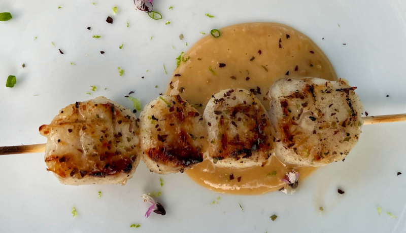
Looking for some ways to add scallops into your rotation? If you need some cooking inspiration, browse these recipes for yakitori scallops, seared scallop salad, and more!
Seafood News
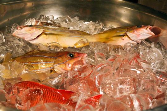 Fresh-caught taʻape on ice. Credit: Conservation International Hawaiʻi.
Reducing Waste and Feeding Communities in Hawaiʻi with a Whole Fish Approach
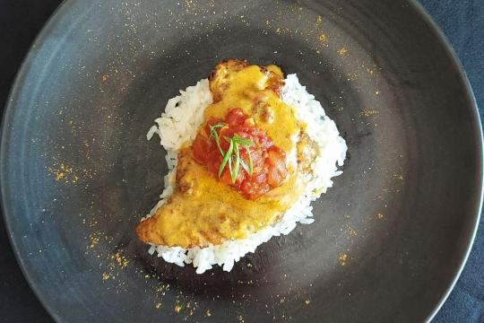 Chef Tyler Hadfield’s Curried Skate Wings with Tomato-Masala Chutney
Ring In the New Year With These Crowd-Favorite Seafood Recipes
 NOAA Fisheries, in collaboration with Blue Ocean Mariculture, is conducting a multi-year pilot study to evaluate observational methods and tools for studying Hawaiian monk seal behavior. Courtesy of Blue Ocean Mariculture
AI Meets Aquaculture to Study Hawaiian Monk Seal Interactions With Net Pens
 Tonya Wick aboard a fishing vessel at sea in 1998. Photo courtesy of Tonya Wick
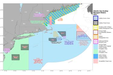
Management Areas

Fishing Year 2025 Rotational Area Coordinates
Access Areas for Fishing Year 2025
Area I Access Area
Point | N Latitude | W Longitude |
AI1 | 40° 55.0´ | 68° 53.4´ |
AI2 | 41° 30.0´ | 69° 23.0´ |
AI3 | 41° 30.0´ | 68° 30.0´ |
AI4 | 40° 58.0´ | 68° 30.0´ |
AI1 | 40° 55.0´ | 68° 53.4´ |
Area II Access Area
| Point | N latitude | W longitude | Note |
| AII1 | 41°30′ | 67°20′ | |
| AII2 | 41°30′ | (1) | (2) |
| AII3 | 40°40′ | (3) | (2) |
| AII4 | 40°40′ | 67°20′ | |
| AII1 | 41°30′ | 67°20′ |
1 The intersection of 41°30′ N lat. and the U.S.-Canada Maritime Boundary, approximately 41°30′ N lat., 66°34.73′ W long.
2 From Point AII2 connected to Point AII3 along the U.S.-Canada Maritime Boundary.
3 The intersection of 40°40′ N lat. and the U.S.-Canada Maritime Boundary, approximately 40°40′ N lat. and 65°52.61′ W long.
Closed Areas Reverting to Open Area
New York Bight Scallop Rotational Area
| Point | N latitude | W longitude |
| NYB1 | 40° 00′ | 73° 20′ |
| NYB2 | 40° 00′ | 72° 30′ |
| NYB3 | 39° 20′ | 72° 30′ |
| NYB4 | 39° 20′ | 73° 20′ |
| NYB1 | 40° 00′ | 73° 20′ |
Closed Areas for Fishing Year 2024
Elephant Trunk
| Point | N latitude | W longitude |
| ET1 | 38°50′ | 74°20′ |
| ET2 | 38°50′ | 73°30′ |
| ET3 | 38°10′ | 73°30′ |
| ET4 | 38°10′ | 74°20′ |
| ET1 | 38°50′ | 74°20′ |
Nantucket Lightship Scallop Rotational Area
Point | N Latitude | W Longitude |
NL1 | 40° 20.0´ | 69° 30.0´ |
NL2 | 40° 20.0´ | 68° 48.0´ |
NL3 | 40° 33.0´ | 68° 48.0´ |
NL4 | 40° 33.0´ | 69° 00.0´ |
NL5 | 40° 50.0´ | 69° 00.0´ |
NL6 | 40° 50.0´ | 69° 30.0´ |
Georges Bank Accountability Measure Area
| Point | N latitude | W longitude | Note |
|---|---|---|---|
| GBAM1 | 41°30′ | 67°20′ | |
| GBAM2 | 41°30′ | (1) | (2) |
| GBAM3 | 40°30′ | (3) | (2) |
| GBAM4 | 40°30′ | 67°20′ | |
| GBAM1 | 41°30′ | 67°20′ |
1 The intersection of 41°30′ N lat. and the U.S.-Canada Maritime Boundary, approximately 41°30′ N lat., 66°34.73′ W long.
2 From Point GBAM2 connected to Point GBAM3 along the U.S.-Canada Maritime Boundary.
3 The intersection of 40°30′ N lat. and the U.S.-Canada Maritime Boundary, approximately, 65°44.34′ W long.Other Atlantic Sea Scallop Management Area Coordinates
NGOM Scallop Management Area
Point | N. Latitude | W. Longitude |
|---|---|---|
NGOM1 | 42°20' | Massachusetts Shoreline |
NGOM2 | 42°20' | 69°40' |
NGOM3 | 42°49.5' | 69°40' |
NGOM4 | 43°12' | 69°00' |
NGOM5 | 43°41' | 68°00' |
G2 | 43°58' | 67°22' |
G1 | Northward along the irregular U.S.-Canada maritime boundary to the shoreline | Northward along the irregular U.S.-Canada maritime boundary to the shoreline |
Georges Bank/Southern New England Scallop Dredge Exemption Area
The Georges Bank/Southern New England dredge exemption area is bounded on the north by 42°20′ N lat.; bounded on the east by the U.S.-Canada Maritime boundary and the outer limit of the US EEZ; bounded on the west by 72°30′ W long. from the outer limit of the US EEZ to the south-facing coastline of Long Island; and bounded on the northwest by the following points, connected as noted in the order listed:
Point | N. Latitude | W. Longitude | Note |
| 1 | The south-facing coastline of Long Island | 72°30′ | From Point 1 to Point 2 following the coastline of Long Island. |
| 2 | 41°00′ | The southeast-facing coast of Long Island | From Point 2 to Point 3 following a straight line. |
| 3 | 41°00′ | The 3 nautical mile line, approximately 71°51.841′ W long | From Point 3 to Point 4 following the Submerged Lands Act (3 nautical mile) line. |
| 4 | 41°4.25′ | The 3 nautical mile line, approximately 71°47.384′ W long | From Point 4 to Point 5 following a straight line. |
| 5 | 41°15′ | 72°2.25′ | Point 5 represents Race Point, Fishers Island, NY. From Point 5 to Point 6 following a straight line northeasterly through Fishers Island, NY. |
| 6 | 41°18.2′ | 71°51.5′ | Point 6 represents Watch Hill, RI. From Point 6 to Point 7 following the coastlines of Rhode Island and Massachusetts. |
| 7 | 42°20′ | The coastline of Massachusetts |
The Mid-Atlantic Exemption Area
This area is bounded on the east by the western boundary of the Southern New England Dredge Exemption area, as described above.
Accountability Measure Areas
Georges Bank Accountability Measure Area
Point | Latitude | Longitude | Note |
|---|---|---|---|
GBAM1 | 41°30’ N | 67°20’ W | |
GBAM2 | 41°30’ N | The intersection of 41°30′ N. lat. and the U.S.-Canada Maritime Boundary, approximately 41°30′ N. lat., 66°34.73′ W. long. | From Point GBAM2 connected to Point GBAM3 along the U.S.-Canada Maritime Boundary. |
GBAM3 | 40°30’ N | The intersection of 40°30′ N. lat. and the U.S.-Canada Maritime Boundary, approximately, 65°44.34′ W. long. | From Point GBAM2 connected to Point GBAM3 along the U.S.-Canada Maritime Boundary. |
GBAM4 | 40°30’ N | 67°20’ W |
|
GBAM1 | 41°30’ N | 67°20’ W |
Mid-Atlantic Accountability Measure Area
All waters west of 71° W. Long.
Science Overview
NOAA Fisheries conducts various research activities on the biology, behavior, and population health of Atlantic sea scallops. The results of this research are used to inform management decisions for this species.
For detailed information about stock status, management, assessments, and resource trends, you can search for Atlantic sea scallop, and any other species of interest, using NOAA’s StockSMART web tool.
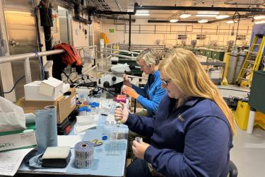
Atlantic Sea Scallop Research in the Northeast
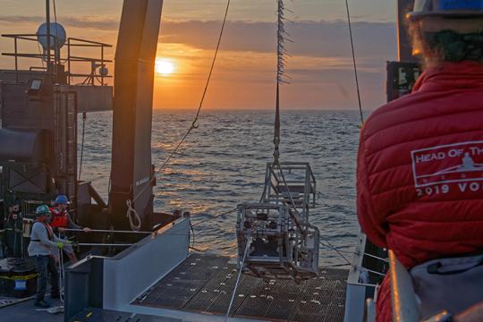
Scientists from NOAA’s Northeast Fisheries Science Center have surveyed the Atlantic sea scallop population off the northeastern United States coast between North Carolina and Massachusetts every year since 1979. They divide the survey area into zones of various depths and habitat, then tow a dredge and camera to randomly sample and document the marine life and other conditions in these zones. After each tow, they sort, count, and measure their catch.
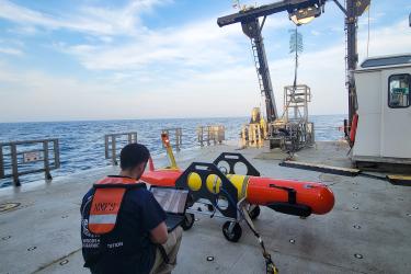
New Technologies to Supplement Dredge Data
Dredge catches provide relative indices of the average density of animals, along with some information about bottom type and habitat. Scientists have recently started using a new undersea camera called the “HabCam” in scallop surveys to supplement the dredge data. The HabCam (short for Habitat Mapping Camera System) was developed by scientists at Woods Hole Oceanographic Institution working with Cape Cod scallop fishermen. Images from the HabCam supply absolute densities of scallops and other species, are less labor intensive in terms of crew, and provide much more information about the bottom habitat, all in near-real time. Using both the annual dredge surveys and the HabCam provides a more complete picture of the scallop population and its habitat.
Sea Scallop Research Set-Aside Program
Under the Sea Scallop Research Set-Aside Program, 1.25 million pounds (567 metric tons) of the allowed scallop harvest is set aside each year to fund scallop and habitat research and surveys to provide better information for future management decisions. This is not a federally-funded program. Participating scallop vessels fund research through the sale of the scallops they harvest. Past projects have focused on gear research to minimize bycatch of finfish, sea turtles, and small scallops; surveys of rotational access areas and other areas; studies of scallop biology; and development of survey technologies.
Research & Data
More Information
- Sea Scallop Stock Assessments
- The Atlantic Sea Scallop: A Fishery Success Story
- Farming Sea Scallops in Maine Offers New Opportunities and Builds Community Res…
- American Lobster, Sea Scallop Habitat Could Shift Off the Northeast
- Understanding Atlantic Sea Scallops and Ocean Acidification
- Sea Scallop Research Set-Aside Projects Selected for 2022–2023