NOAA Fisheries’ Alaska Fisheries Science Center is developing and deploying innovative tools to collect information essential to maintain healthy ecosystems, conserve marine mammals populations, manage sustainable fisheries, and foster climate-resilient communities.
Emerging technologies such as drones, moored sonars, specialized camera systems, and eDNA complement traditional sampling methods. They increase coverage, minimize environmental impact, speed data delivery, and improve cost-efficiency. Cutting-edge chemical analyses are revolutionizing our ability to obtain information about the age and biology of fish. Advances in artificial intelligence enable fast, accurate data processing and analysis.
Here are some examples of the tools and technologies the Alaska Fisheries Science Center is leveraging for more effective, efficient sampling of Alaska’s vast marine environment.

Uncrewed Surface Vehicles work in tandem with NOAA ships on Alaska pollock acoustic surveys to cover the same area in 40% less time than a ship working alone, while still allowing for collection of critical biological data from the ship. These versatile tools are also used to track marine mammals on extended foraging trips.

Our eDNA program is using genetic material shed by organisms into the surrounding water to characterize fish communities, assess species diversity, and identify important fish habitat.

3D stereo camera systems developed at Alaska Fisheries Science Center provide powerful, versatile remote sampling tools for an array of research needs—from surveying untrawlable fish habitat to discovering deep-sea coral habitat on unexplored seamounts. Artificial intelligence automates image processing to speed data delivery and save costs.

We teamed up with Microsoft AI for Earth to develop artificial intelligence to detect seals and polar bears on sea ice in millions of color and thermal images collected during Arctic aerial surveys.

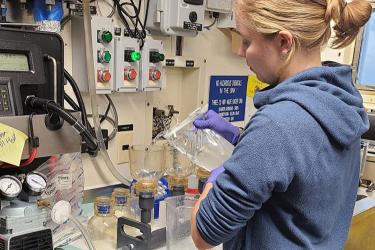
We are using AI and near-Infrared analysis of otoliths (ear stones) to age Alaska pollock. With this new technology, scientists can determine fish ages faster— 30–50 seconds per otolith, which is more than 10 times faster than humans using microscopes. Success with this effort could revolutionize the way fish ages are estimated throughout the world.

Alaska Fisheries Science Center scientists also are pioneering the use of near-infrared analysis of otoliths to identify fish species and populations.
New underwater microscope camera technology greatly expands our ability to study how environmental change affects zooplankton, important food for many commercial fish. The camera collects zooplankton images while mounted on oceanographic instruments that simultaneously collect environmental data.
An innovative instrument that continuously takes images of phytoplankton at sea is transforming the way we research and monitor these tiny algae. Phytoplankton form the base of the food web for all marine animals. Some species form harmful algal blooms.

Autonomous underwater vehicles can track acoustically tagged fish while simultaneously collecting data on their environment. These underwater robots can operate independently for over 12 hours.

We are using Uncrewed Aerial Systems or “Hexacopters” to survey marine mammals such as seals and sea lions. These instruments can photograph animals from great distances with minimal impact to the animals or environment. They can fly beneath clouds and at a lower cost than manned aerial surveys.

Alaska Fisheries Science Center is modernizing fishery monitoring by developing electronic monitoring systems and using machine learning to automate processing of images collected onboard fishing vessels.

Seafloor-mounted SONARs collect continuous acoustic data on fish movements and abundance over years to help us better understand how changing environmental conditions influence fish populations.

Since 2007, we have been monitoring trends in marine mammal movement, calling behavior, and human-generated noise from year-round passive acoustic recordings by equipment moored at 23 sites.
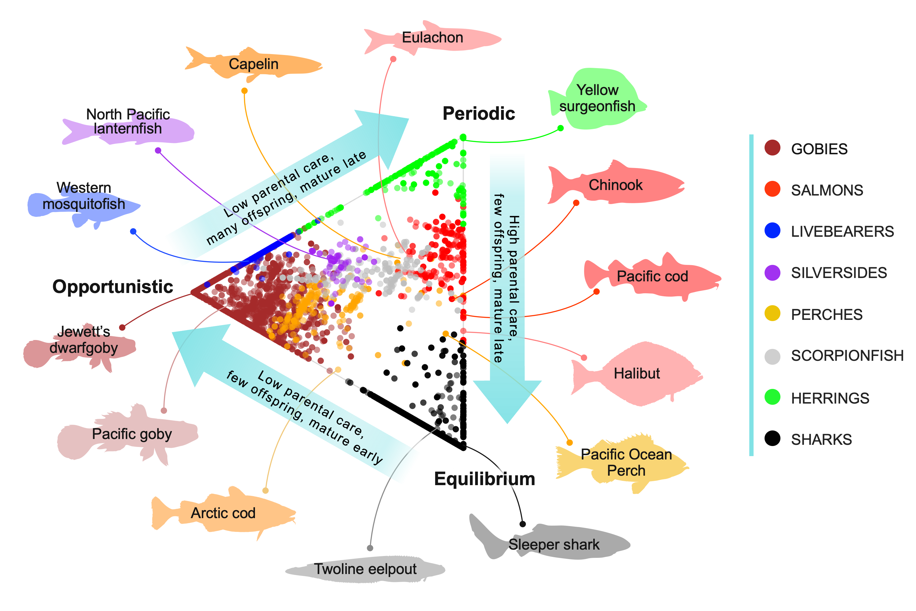
For the first time, new state-of-the-art modelling can help scientists predict growth, survival, and reproductive strategies for all known fish in the world. This new model uses 33 traits that describe size, growth, reproduction, parental care, and lifespan to classify more than 34,000 fish species.